“Turn left at Seneca Rocks, drive north to Cabins, just before Cabins cross bridge to gravel road. Go up gravel road 3.6 miles. Park on right; trail on left goes down mountain to river.” Those were the instructions written on the back of a napkin while at a family reunion where one of my older cousins gave me directions to his favorite fishing spot on the South Branch of the Potomac River. Sounded easy enough.
With about two weeks left in my summer before heading back to “We Are” Marshall University, me and my buddy Jeff decided we were all-in for this trip.
The plan was to leave after work on Friday. It was about a four hour drive which would put us there with about an hour of daylight to get to the river. Should be plenty of time. When we loaded the truck it would have been very apparent to any experienced backpacker that Jeff and I were not experienced. Our external frame packs were filled to the hilt with gear, not limited to but including: a full-size Coleman 2-burner stove, cases of beer, coolers of cheese and lunch meat, and enough 1 pound propane bottles to supply an expedition for two weeks.
We left work right on time. Anyone who has seen Seneca Rocks knows how beautiful they are, and we arrived there in the daylight and took the left turn as instructed on the napkin. Up route 28 we went toward Cabins. Once in the little town of Cabins we started looking for our bridge. Sure enough, there above the trees we could see the old blue and rust colored girders of an old iron bridge. We turned off of the highway and down the street to the bridge. Posted on the side of the bridge was a “No Trespassing” sign. This was curious, we thought. On the other side of the bridge we hit a gravel road just as described by my cousin. This gravel road went away from the river through a valley that was full of deer. We could not help but pull over and look them over for a few minutes before continuing on for to the 3.6 mile marker. We continued down the gravel road and we both spoke that it seemed odd that we seemed to be driving away from the river. The gravel road then started up a hill, made an abrupt turn to the left, and ended at someone’s cedar home.
This is the point in the story where the “what could possibly go wrong” list got its start. As I shifted my little black Ford Ranger back into first gear and started to let off the clutch I heard Jeff say “Oh Crap!” I looked at Jeff and saw that Jeff was wide-eyed watching a man in his boxer shorts jumping off the porch of the home and running toward our truck a fast as he could, yelling some things we could not understand all the while.
Even though I was curious as to what he was yelling, I was pretty sure it was not welcoming so I popped the clutch and headed back out the gravel road much to Jeff’s encouragement. Apparently we were about 3/4 of a mile from the bridge, and driving 45mph down a gravel drive in August can make quite a dust cloud. This made it difficult to tell what was behind us. We paused just before crossing back over the bridge. It has been nearly twenty five years, but I can still clearly remember the vision of that red Chevy truck come flying out of the dust cloud in hot pursuit of those who had just violated the sovereignty of his compound.
We crossed the bridge back the highway and I said “Left or Right?!?” Jeff said “Left.” I turned right. So up the road toward Petersburg we went. Now that little Ranger was a two wheel drive with a six cylinder, so it would roll. However, this did not matter. About 15 inches off of my back bumper was a half-ton red Chevrolet driven by a very angry man who was now talking on a CB. This is when Jeff reached under the seat and pulled out his 44 magnum. I forgot to mention this three pound gun earlier when discussing the packing list. I’m not sure what Jeff thought he would do with it, but it made him feel better I guess knowing if he was going to die today he was at least going down in a fight. Jeff never got the chance though because I never slowed down until I got to Petersburg. I pulled into the first populated parking lot I found, stopped the truck, looked around, and the Chevy was gone. I guess the most powerful handgun in the world scared him off.
This seemed like a good time to look at a map. After a sigh of relief and a few laughs we started tracing highway lines and rivers and sure enough, there it was, the point where a road crossed the river just south of Cabins; we had driven right by it. This, of course, now meant we had to drive back through Cabins and possibly reinfuriate our new friend. I bet we looked funny driving back through town all slumped down in our seats. Just south of town like an apparition there appeared our bridge, and just on the other side was a gravel road and a sign indicating we were on public land. Well all-be-damned if that didn’t make more sense.
Up the mountain we went, headlights on now because it was getting dark, and closely watching the odometer until we hit the prescribed mile marker and the pull-off spot. We happily exited the little truck and took in the surroundings. To our right was a steep uphill climb toward the top of the mountain. To the left was a sharp downhill decent into darkness. There was no path. There was no sound of a river.
Standing there in the dark we had a quick conference and concluded that, since water runs downhill, the river must be somewhere at the bottom. If we would simply walk downhill far enough we would eventually hear water and, ta-da, find the river. So, off we went down the mountain through a subtle drawl, with cases of beer tied on top of our frame packs, Jeff with a cooler in one hand and fishing rods in the other, and me with a lantern in one hand and fishing rods in the other. We were the kind of backpackers that real backpackers make fun of.
Our journey down the mountain was in no way without it’s own challenges. Much to our surprise we did find a somewhat well-traveled path. But then we would lose it. And then we would find it again. We crossed fences and gates, and several small stream crossings as well. On one such stream crossing Jeff was standing on a big, flat, sloped rock along the waters edge. We were having a debate about how tall the mountain was and thus how much further it could be to the river when Jeff’s feet went straight in the air. His backpack hit that rock so hard that he shattered a brand new bar of dial soap and dented his 2-burner Coleman stove. The beer was fine, however, and it took both of us to get the turtle off of his back.
On the very next stream crossing the nut that held the shade and handle on my Coleman lantern fell off as I was mid-stride across the water. The lantern, somehow, landed perfectly on a rock and didn’t tip over, but the nut was long gone. This was the 90’s and we didn’t have LED lanterns, fancy headlamps, or anything other than 2-D flashlights – so the lantern was critical. So I got to carry my lantern by the bottle for the remainder of the trip.
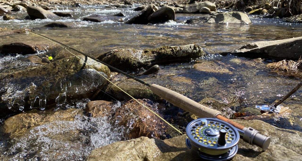
Gravity always seems to prove reliable and so our little stream did eventually lead to the South Branch. I can still remember seeing the huge gap in the rock formation that opened-up into the river valley, highlighted by the night sky. There is a large pool in the river at that gap that stretches nearly 40 feet across. Over the next two days I would catch multiple smallmouth over 15” on a 5 weight fly rod from that hole.

Those two days on the South Branch became the foundation for my love of fishing. We were in a deep river canyon with no other person around. We fished upstream for two miles and downstream for a half mile and caught fish in every direction. We saw osprey and eagles, we ate fish, and took naps beneath the rock outcrops; we were kings.
The final lesson came on the way out. When you walk 2.5 miles in the dark, without a map, without a trail, and with poor lighting – things look a little different on the way back out. We thought we had it made following an actual trail until we came to the junction of two little tributaries. Just like the bridge in Cabins, we had to choose the left fork or the right fork. This time I let Jeff pick and he picked the left fork. Well about a mile above the fork in the stream we concluded the left fork was not the “right fork.” But once you are a mile up the wrong mountain sometimes it is best to just pretend it is the correct one and keep walking. We knew there was a road up there somewhere. This theory proved-out when we hit a little dirt lane. Exhausted, lost, smelly, and humbled we started down the road. It wasn’t long before a white Isuzu Trooper was headed our way (we were relieved it was not a red Chevy half-ton). Low and behold it was family from Washington DC on the way to their cabin for a vacation – and they were friendly. I still remember his reaction when I asked if they had seen a black Ford Ranger. “Is that yours? Boy, you are long way from that truck!” I was never so happy to catch a ride.
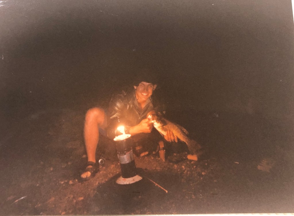
Over the last two decades I made it back to the South Branch a few times. Once trip I went alone and came back with a huge gash on my forehead that left a scar (story for another day). Another time I took a Boy Scout troop down the gap, and once just my son and I went in for a long weekend. I have an awesome picture of him on my desk, asleep in the afternoon sun along the river.

Then last weekend I took a drive. I had not intended to go to the South Branch, but that is where the day took me. Blue skies and snow melt are not a great combination for a fish bite, which is the excuse I am going to use for not even spurring one hit. But as soon as I stepped in the river I was in a place remembered. And as the familiar water surrounded me I was taken back to the memory of all those trips before and those who had shared the water with me on those days.
At the end of the line, that is the catch with the most meaning: the memories made and those we shared them with. And in its truest sense, that is why we fly fish, and that is why we seek solitary places. Our souls need that time. Our lives need that depth. Our days need such memories.
